State Route 88, known as the Apache Trail, is one of Arizona’s most historic and scenic roadways. In recent years, wildfires and flooding have compromised the corridor, destabilizing slopes, washing out culverts and causing extended road closures. The damage left ADOT facing rising maintenance costs and the public with limited access to nearby forest lands.
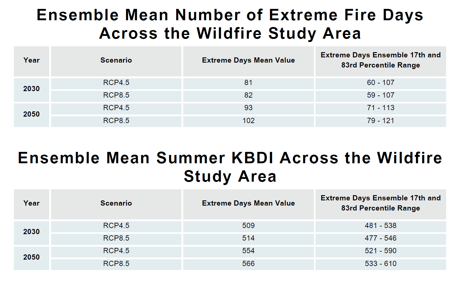
Stanley Consultants, supported by Resilient Analytics, led a Design Concept Report for ADOT to address these challenges. Resilient Analytics modeled how wildfire and storm events could affect a portion of SR 88 over the next 20 years, identifying the areas most vulnerable to erosion, slope failures and drainage system overload. This modeling gave ADOT a clear view of long-term risks and informed critical design criteria for recommended infrastructure improvements.
Guided by this data, Stanley’s transportation team designed concepts that balanced infrastructure resilience with historic preservation. Improvements included cross-section refinements, slope and rockfall stabilization, upgraded drainage, roadside safety enhancements, and selective bridge rehabilitation or replacement. Surface treatments were selected to reduce weekly maintenance while maintaining the road’s natural character, historic stonework and cultural features.
The recommendations will result in a safer, more resilient roadway that preserves the historic character. By combining climate analytics with innovative engineering, Stanley Consultants and Resilient Analytics restored reliable access and protected one of Arizona’s most treasured routes from future disruption.
